


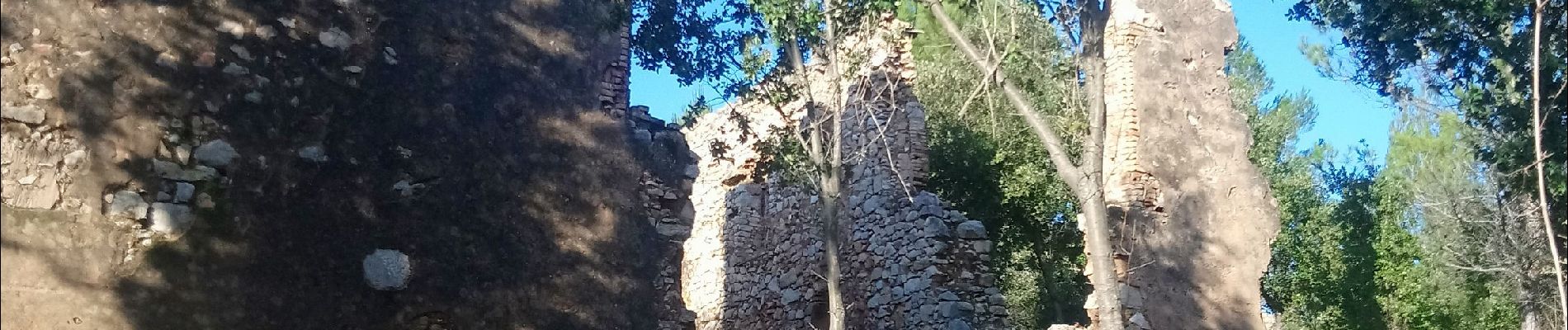
fond du broc. Roseline

Michel DUBOIS
User
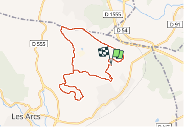

Length
9.6 km

Max alt
215 m

Uphill gradient
185 m
Km-Effort
12.1 km

Min alt
135 m

Downhill gradient
184 m
Boucle
Yes
Creation date :
2019-12-09 08:05:49.338
Updated on :
2019-12-09 11:16:15.541
3h09
Difficulty : Very easy

FREE GPS app for hiking
 SityTrail
IGN / Geographical institutes
SityTrail Plus
The world is yours!
About
Trail Walking of 9.6 km to be discovered at Provence-Alpes-Côte d'Azur, Var, Les Arcs-sur-Argens. This trail is proposed by Michel DUBOIS.
Photos


Positioning
Country:
France
Region :
Provence-Alpes-Côte d'Azur
Department/Province :
Var
Municipality :
Les Arcs-sur-Argens
Location:
Unknown
Start:(Dec)
Start:(UTM)
298406 ; 4816627 (32T) N.
Comments